Import a GPX file

Le Fouilly trails

Click on a trail to view its statistics, map and profile.
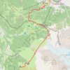
Day 01: Les Houches to Auberge du Truc

France > Auvergne-Rhône-Alpes > Upper Savoy > Les Houches > Le Fouilly

Distance: 8.8 mi • Elevation gain: 4,856 ft • Maximum elevation: 6,946 ft

Gear up for your next adventure:

🧥Men's Rain Shells - Premium waterproof and breathable jackets for mountain weather
🧤Hiking Gloves - Protective gloves for rugged trails
💧Water Filtration Bottles - Safely drink from streams and lakes while exploring
🥄Camping Utensil Set - Lightweight utensils for outdoor meals
🏫Relief Map Kits - Hands-on tools for teaching landforms and elevation

As an Amazon Associate, this site earns from qualifying purchases at no extra cost to you.