Import a GPX file

Lincoln County, Missouri, United States trails

Click on a trail to view its statistics, map and profile.
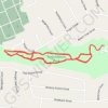
Troy Kiwanis Park main trail asphalt paved

United States > Missouri > Lincoln County > Troy

Distance: 3.0 mi • Elevation gain: 98 ft • Maximum elevation: 571 ft
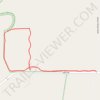
BK Leach Memorial Conservation Area

United States > Missouri > Lincoln County

Distance: 2.7 mi • Elevation gain: 33 ft • Maximum elevation: 446 ft

Gear up for your next adventure:

🧢Outdoor Hiking Hat - Sun protection hat for outdoor explorers
🎒Waterproof Dry Bags - Keep your electronics and maps dry inside your pack
📡Handheld GPS Device - Reliable handheld GPS for outdoor navigation
🖼️Topo Map Wall Art - Decorative topographic prints of famous peaks and regions
🌡️Portable Weather Meter - Track weather conditions on the trail

As an Amazon Associate, this site earns from qualifying purchases at no extra cost to you.