Import a GPX file

LowerSeymour trails

Click on a trail to view its statistics, map and profile.
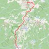
Pump Peak

Canada > British Columbia > Metro Vancouver Regional District

Lower Seymour Conservation Reserve. #Hiking #Snowshoeing #Ski #LowerSeymour

Distance: 4.3 mi • Elevation gain: 1,509 ft • Maximum elevation: 4,560 ft
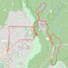
Lynn Valley - Rice Lake

Canada > British Columbia > Metro Vancouver Regional District

Lower Seymour Conservation Reserve. #Hiking #MTB #Loop #Lynn #Rice #LowerSeymour

Distance: 12.3 mi • Elevation gain: 2,159 ft • Maximum elevation: 761 ft

Dog Mountain

Canada > British Columbia > Metro Vancouver Regional District

Lower Seymour Conservation Reserve. #Hiking #Snowshoeing #LowerSeymour

Distance: 2.8 mi • Elevation gain: 587 ft • Maximum elevation: 3,442 ft

Gear up for your next adventure:

🧣Merino Neck Gaiters - Multi-functional headwear for wind and sun protection
🪑Ultralight Camp Chairs - Portable seating for resting after a long day of mapping
🎒Day Hiking Backpack - Lightweight backpack perfect for day trips and outdoor adventures
🪓Survival Multi‑Tool - Versatile tool for camp and trail tasks
🪶Survival Guide Book - Expert advice for emergency preparedness

As an Amazon Associate, this site earns from qualifying purchases at no extra cost to you.