Import a GPX file

Monroe County, Ohio, United States trails

Click on a trail to view its statistics, map and profile.
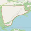
Malabar Farms Connector

United States > Ohio > Richland County > Perrysville > Richland Cottage Area

Distance: 2.0 mi • Elevation gain: 66 ft • Maximum elevation: 1,083 ft

Gear up for your next adventure:

🎒Waterproof Dry Bags - Keep your electronics and maps dry inside your pack
📌Outdoor GPS Map App - Apps and devices for digital topographic navigation
⌚Solar GPS Watches - Advanced multisport watches with built-in topographic maps
🏕️Tent Footprint - Protect your tent base from wear
🚁Photography Drones - Capture stunning aerial views of landforms and topography

As an Amazon Associate, this site earns from qualifying purchases at no extra cost to you.