
Mount Pemigewasset Trail in Franconia Notch State Park trails
Click on a trail to view its statistics, map and profile.
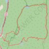
Mount Lafayette Loop
United States > New Hampshire > Grafton County > Lincoln
The Mount Lafayette Loop begins in Franconia Notch, at the edge of the White Mountain National Forest, and climbs away from the parkway into shaded hardwood and spruce forest. The route follows the Falling Waters side of the loop beside Walker Brook and Dry Brook, passing Stairs Falls and Cloudland Falls as…
Distance: 8.4 mi • Elevation gain: 3,734 ft • Maximum elevation: 5,190 ft

Mount Pemigewasset Trail in Franconia Notch State Park
United States > New Hampshire > Grafton County > Lincoln
The Mount Pemigewasset Trail offers a relatively short but rewarding hike through the forest with beautiful views as you ascend. Along the way, hikers pass through tunnels beneath the highway and climb steady, rocky paths that lead to a broad summit. From the peak, the panoramic views extend across the…
Distance: 3.5 mi • Elevation gain: 1,227 ft • Maximum elevation: 2,484 ft