Import a GPX file

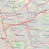
Ourcq trails

Click on a trail to view its statistics, map and profile.

Canal de l'Ourcq

France > Ile-de-France > Seine-Saint-Denis > Tremblay-en-France

#Randonnée #Ourcq #Paris

Distance: 16.1 mi • Elevation gain: 404 ft • Maximum elevation: 223 ft

Gear up for your next adventure:

🪑Portable Camp Table - Compact table for campsite meals
🛰️Handheld GPS Units - Professional satellite navigators for precise backcountry mapping
🪓Survival Multi‑Tool - Versatile tool for camp and trail tasks
🎒Day Hiking Backpack - Lightweight backpack perfect for day trips and outdoor adventures
🪶Trail Camera - Capture wildlife on your hikes

As an Amazon Associate, this site earns from qualifying purchases at no extra cost to you.