Import a GPX file

Pomona Loop trails

Click on a trail to view its statistics, map and profile.
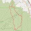
Bane Canyon Loop

United States > California > San Bernardino County > Chino Hills

Beginning near the North Entrance off Sapphire Road, the loop briefly follows Bane Canyon Road into Chino Hills State Park before leaving the paved corridor for the East Fence Line Trail, where rolling grasslands, coastal sage scrub, spring wildflowers, and views across Bane Canyon and the nearby urban edge…

Distance: 7.6 mi • Elevation gain: 1,427 ft • Maximum elevation: 1,171 ft
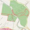
Yurol State Forest Loop

Australia > Queensland

Loop hike / run in the Yurol State Forest. #Hiking #Running #Loop #Forest #Nature

Distance: 7.9 mi • Elevation gain: 472 ft • Maximum elevation: 420 ft

Pomona Loop

Australia > Queensland > Pomona

#MTB #Loop

Distance: 23.8 mi • Elevation gain: 1,955 ft • Maximum elevation: 702 ft

Pomona Loop

Australia > Queensland > Pomona

#MTB #Loop

Distance: 39.5 mi • Elevation gain: 4,478 ft • Maximum elevation: 1,509 ft

Gear up for your next adventure:

🛶Inflatable Kayak - Portable kayak for rivers, lakes, and expeditions
🧯Emergency Survival Kit - All‑in‑one survival essentials for the backcountry
🪓Survival Multi‑Tool - Versatile tool for camp and trail tasks
👟Trail Running Shoes - Lightweight shoes for trail runners
🏕️Family Camping Gear - Essentials for group camping trips

As an Amazon Associate, this site earns from qualifying purchases at no extra cost to you.