Import a GPX file

Queen Victoria via Queen s Garden Trail in Bryce Canyon National Park trails

Click on a trail to view its statistics, map and profile.
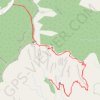
Queen Victoria via Queen's Garden Trail in Bryce Canyon National Park

United States > Utah > Garfield County

The Queen's Garden Trail in Bryce Canyon National Park offers hikers a journey through a landscape adorned with unique rock formations, including the Queen Victoria hoodoo, which resembles a regal figure. The path meanders through a natural amphitheater, providing expansive views of the park's distinctive…

Distance: 2.0 mi • Elevation gain: 430 ft • Maximum elevation: 7,982 ft
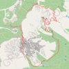
Navajo Loop Trail and Queen's Garden Trail in the Bryce Canyon

United States > Utah > Garfield County

Loop hike in the Bryce Canyon National Park via Rim Trail, Sunset Point, Navajo Loop Trail, Wall Street, Queen's Garden Trail, Queen Victoria and Sunrise Point. #Hiking #Loop #Canyon #Nature #Rock #Forest #Park #Bryce

Distance: 3.2 mi • Elevation gain: 702 ft • Maximum elevation: 8,015 ft

Gear up for your next adventure:

🚗GPS Dash Cams - Record your scenic drives through mountain passes and canyons
🥾Men's Hiking Boots - Durable, waterproof footwear for rugged terrain and steep inclines
🥾Women's Hiking Boots - Top-rated trail boots with ankle support and superior grip
📶Satellite Messenger - Communication device off‑grid
🧷Carabiner Set - Durable clips for gear attachment

As an Amazon Associate, this site earns from qualifying purchases at no extra cost to you.