
RockyMountains trails
Click on a trail to view its statistics, map and profile.

Twin Peaks
United States > Utah > Salt Lake County > Alta
Cecret Lake, Mount Baldy, Hidden Peak. Rocky Mountains. #Hiking #RockyMountains
Distance: 9.6 mi • Elevation gain: 3,619 ft • Maximum elevation: 11,440 ft
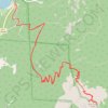
Twin Sisters Peak from Lily Lake
United States > Colorado > Larimer County > Estes Park
Rocky Moutains. #Hiking #RockyMountains
Distance: 7.6 mi • Elevation gain: 2,441 ft • Maximum elevation: 11,365 ft