Swain County, North Carolina, United States trails
Click on a trail to view its statistics, map and profile.
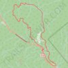
Smokemont loop hike
United States > North Carolina > Swain County > Smokemont
Distance: 8.9 mi • Elevation gain: 2,487 ft • Maximum elevation: 3,540 ft

Deep Creek Waterfall Loop in Great Smoky Mountains National Park
United States > North Carolina > Swain County > Deep Creek
The Deep Creek Waterfall Loop in Great Smoky Mountains National Park offers hikers a serene journey through lush forests, accompanied by the soothing sounds of flowing water. Along the trail, visitors can observe notable waterfalls, including Juney Whank Falls, Indian Creek Falls, and Tom Branch Falls, each…
Distance: 2.4 mi • Elevation gain: 620 ft • Maximum elevation: 2,267 ft

Charlies Bunion via Appalachian Trail from Newfound Gap in Great Smoky Mountains National Park
United States > North Carolina > Swain County
The hike to Charlies Bunion is a rewarding experience characterized by stunning panoramic views of the Great Smoky Mountains. As you traverse the Appalachian Trail, you'll encounter diverse landscapes, including dense forests of Fraser fir and red spruce, as well as several scenic overlooks that reveal…
Distance: 8.2 mi • Elevation gain: 2,224 ft • Maximum elevation: 6,073 ft

Waterfalls Loop via Deep Creek Trail in Great Smoky Mountains National Park
United States > North Carolina > Swain County > Deep Creek
This Waterfalls Loop via the Deep Creek Trail in the Great Smoky Mountains National Park offers a serene and scenic hiking experience. Along the way, hikers encounter three picturesque waterfalls: Juney Whank Falls, Indian Creek Falls and Tom Branch Falls. Each waterfall has its own charm, with the cascading…
Distance: 2.4 mi • Elevation gain: 617 ft • Maximum elevation: 2,267 ft
Kuwohi Trail to Observation Tower in the Great Smoky Mountains National Park
United States > North Carolina > Swain County
The hike to the Kuwohi Observation Tower offers stunning panoramic views from the highest point in the park, previously known as Clingmans Dome. As you ascend the paved, yet steep, trail, you'll be rewarded with vistas of expansive mountain ranges, including Sugarland Mountain and the Elkmont area. On clear…
Distance: 1.3 mi • Elevation gain: 348 ft • Maximum elevation: 6,631 ft