
The Enchantments trails
Click on a trail to view its statistics, map and profile.
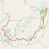
The Enchantments
United States > Washington > Chelan County
From the Stuart Lake Trail, the route enters the Alpine Lakes Wilderness through forest, creek crossings, and gradually rougher alpine terrain before reaching Colchuck Lake, a striking first landmark set below Colchuck Peak and Dragontail Peak, with Aasgard Pass rising steeply above the far shore as the…
Distance: 18.2 mi • Elevation gain: 4,928 ft • Maximum elevation: 7,818 ft

Lake Stuart via Stuart Lake Trail in Alpine Lakes Wilderness
United States > Washington > Chelan County
The hike to Lake Stuart in the Alpine Lakes Wilderness offers a serene journey through lush forests, alongside Mountaineer Creek, and past impressive glacial boulders. The route gradually transitions from shaded woodland paths to expansive meadows that unveil stunning views of Mount Stuart towering above the…
Distance: 4.1 mi • Elevation gain: 1,765 ft • Maximum elevation: 5,118 ft