
Whiteside Mountain Loop Trail in Nantahala National Forest trails
Click on a trail to view its statistics, map and profile.
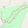
Whiteside Mountain Loop Trail in Nantahala National Forest
United States > North Carolina > Macon County
The Whiteside Mountain Loop Trail offers a striking blend of natural beauty and rich history in North Carolina's Nantahala National Forest. As you hike, the views are dominated by towering cliffs that drop over 750 feet to the valley below, offering sweeping panoramas of the surrounding mountain ranges,…
Distance: 2.1 mi • Elevation gain: 764 ft • Maximum elevation: 4,806 ft
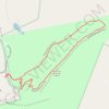
Whiteside Mountain Loop Trail in Nantahala National Forest
United States > North Carolina > Macon County
The Whiteside Mountain Loop Trail in the Nantahala National Forest offers an enjoyable yet moderately challenging hiking experience. As you ascend through a mix of hardwood forests, the trail leads to spectacular views over the surrounding mountains, including the expansive Nantahala National Forest and parts…
Distance: 2.1 mi • Elevation gain: 741 ft • Maximum elevation: 4,806 ft