Import a GPX file

Winona County, Minnesota, United States trails

Click on a trail to view its statistics, map and profile.
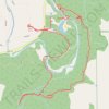
Whitewater State Park - Chimney Rock, Inspiration Point and Coyote Point loop

United States > Minnesota > Winona County > Elba Township

Distance: 3.3 mi • Elevation gain: 640 ft • Maximum elevation: 1,119 ft

King's Bluff Overlook

United States > Minnesota > Winona County

Hike to King's Bluff Overlook via Park Road and King's Bluff Trail in the Great River Bluffs State Park and the King's and Queen's Bluffs Scientific and Natural Area. #Hiking #Nature #Forest #River #Park

Distance: 4.0 mi • Elevation gain: 361 ft • Maximum elevation: 1,289 ft

Gear up for your next adventure:

🪶Camping Sleeping Pad - Comfortable sleeping pad for backpacking
🔭Telescopic Hiking Pole - Adjustable pole for hiking stability
🧭Compass with Lanyard - Easy‑carry compass for navigation
🛰️Satellite Messengers - Emergency SOS and two-way messaging for off-grid adventures
📶Vehicle Signal Boosters - Improve reception in rural areas while driving to trailheads

As an Amazon Associate, this site earns from qualifying purchases at no extra cost to you.