
Wrights Lake and Enchanted Pools Loop trails
Click on a trail to view its statistics, map and profile.
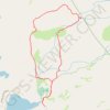
Wrights Lake and Enchanted Pools Loop
United States > California > El Dorado County
From the Wrights Lake trailhead area, this loop leaves the lakeshore through the inlet meadows and forest, joining the Twin Lakes Trail in the Eldorado National Forest and at the edge of Desolation Wilderness. It then heads toward the Enchanted Pools, where South Fork Silver Creek works through polished…
Distance: 4.0 mi • Elevation gain: 449 ft • Maximum elevation: 7,313 ft