Wrights Lake and Enchanted Pools Loop
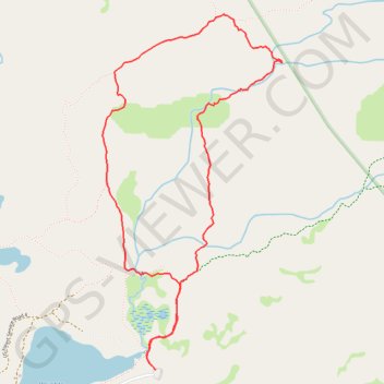
From the Wrights Lake trailhead area, this loop leaves the lakeshore through the inlet meadows and forest, joining the Twin Lakes Trail in the Eldorado National Forest and at the edge of Desolation Wilderness.
It then heads toward the Enchanted Pools, where South Fork Silver Creek works through polished granite into pools and cascades, before curving around the Tyler Lake Trail and Rockbound Trail sector among open Sierra slabs, sparse woodland, and mountain views.
The return closes the loop by descending toward Old Corral Loop Trail and Wrights Lake, bringing the main scenery in sequence: lake, marshy creek, forest, granite pools, falling water, mountain terrain, and the quiet lakeside basin.
#Hiking #Loop #Lake #Nature #Forest #Mountain #River #Falls #Wilderness #Pools
- Distance: 4.0 mi
- Elevation gain: 449 ft
- Maximum elevation: 7,313 ft
- Elevation loss: 446 ft
- Minimum elevation: 6,962 ft
- Moving time: 2 h 57 m
- Moving speed: 1.4 mph
- Maximum speed: 3.7 mph
- Total time: 3 h 15 m
- Global speed: 1.2 mph
Interactive trail map
Trail profile
- Distance: 4.0 mi
- Elevation gain: 449 ft
- Maximum elevation: 7,313 ft
- Elevation loss: 446 ft
- Minimum elevation: 6,962 ft
- Moving time: 2 h 57 m
- Moving speed: 1.4 mph
- Maximum speed: 3.7 mph
- Total time: 3 h 15 m
- Global speed: 1.2 mph
About this trail
Name: Wrights Lake and Enchanted Pools Loop trail, distance, elevation, map, profile, GPS track
Start: Service road, El Dorado County, California, United States (38.84961 -120.22570)
End: Service road, El Dorado County, California, United States (38.84959 -120.22562)
Coordinates: 38.84959 -120.22946 38.86938 -120.21664
Topography: El Dorado County topographic map, elevation, terrain