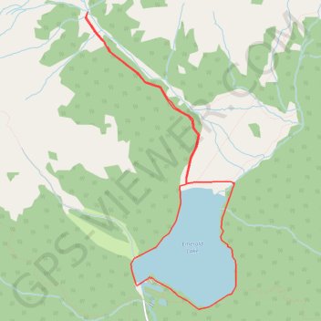
Emerald Lake - Emerald Basin
Interactive trail map
Trail profile
- Distance: 6.7 mi
- Elevation gain: 958 ft
- Maximum elevation: 4,915 ft
- Elevation loss: 961 ft
- Minimum elevation: 4,259 ft
About this trail
Name: Emerald Lake - Emerald Basin trail, distance, elevation, map, profile, GPS track
Coordinates: 51.43680 -116.55081 51.46993 -116.52388
Other hiking, mountain biking, running and outdoor activity trails
Click on a trail to view its statistics, map and profile.