Import a GPX file

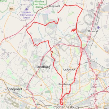
Johannesburg

#Bike #Loop

  • Distance: 57.8 mi
  • Elevation gain: 4,875 ft
  • Maximum elevation: 5,751 ft
  • Elevation loss: 4,875 ft
  • Minimum elevation: 4,354 ft

Interactive trail map

Trail profile

  • Distance: 57.8 mi
  • Elevation gain: 4,875 ft
  • Maximum elevation: 5,751 ft
  • Elevation loss: 4,875 ft
  • Minimum elevation: 4,354 ft

About this trail
Gear up for your next adventure:

🧢Sun Protection Hats - Wide-brimmed and UPF-rated hats for high-altitude sun safety
🗺️Topographic Maps - Detailed topo maps for hiking, exploring and outdoor navigation
🛠️Outdoor Gear Repair Kit - Essential tools to fix gear on the trail
🔭Stargazing Telescopes - Perfect for camping in low-light pollution areas shown on maps
🎒Outdoor Daypacks - Lightweight backpacks designed for carrying maps and essential gear

As an Amazon Associate, this site earns from qualifying purchases at no extra cost to you.