Northbrook Mountain
Interactive trail map
Trail profile
- Distance: 6.9 mi
- Elevation gain: 961 ft
- Maximum elevation: 2,283 ft
- Elevation loss: 2,612 ft
- Minimum elevation: 518 ft
About this trail
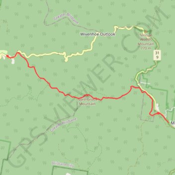
Name: Northbrook Mountain trail, distance, elevation, map, profile, GPS track
End: Northbrook Parkway, Dundas, Somerset Regional, Queensland, Australia (-27.30576 152.68665)
Coordinates: -27.33369 152.68575 -27.30418 152.76204
Other hiking, mountain biking, running and outdoor activity trails
Click on a trail to view its statistics, map and profile.
Northbrook Mountain & Gorge
Loop run / trail / hike via Northbrook Parkway, Wivenhoe Outlook, Switchback Road, Cattleyards Break, England Creek Road, Northbrook Mountain bush Camp, Northbrook Mountain, Lawton Road and Northbrook Gorge Trail in d'Aguilar National Park. #Running #Trail #Hiking #Mountain #Nature #Forest #Park
Distance: 15.2 mi • Elevation gain: 4,170 ft • Maximum elevation: 2,047 ft
Northbrook Mountain, England Creek and back up via Joyners Break
Distance: 24.9 mi • Elevation gain: 5,738 ft • Maximum elevation: 2,316 ft