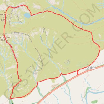
Blencathra - Lake District National Park
Interactive trail map
Trail profile
- Distance: 5.1 mi
- Elevation gain: 2,244 ft
- Maximum elevation: 2,792 ft
- Elevation loss: 2,244 ft
- Minimum elevation: 732 ft
About this trail
Name: Blencathra - Lake District National Park trail, distance, elevation, map, profile, GPS track
Coordinates: 54.62680 -3.04983 54.64598 -3.01587
Other hiking, mountain biking, running and outdoor activity trails
Click on a trail to view its statistics, map and profile.
Blencathra hike
United Kingdom > England > Westmorland and Furness > Scales
Distance: 5.2 mi • Elevation gain: 2,073 ft • Maximum elevation: 2,802 ft
Blencathra, Knott and Skiddaw loop
United Kingdom > England > Cumberland > Keswick
Distance: 48.3 mi • Elevation gain: 14,311 ft • Maximum elevation: 3,025 ft
Blencathra and local peaks
United Kingdom > England > Westmorland and Furness > Scales > Guardhouse
Hike
Distance: 8.8 mi • Elevation gain: 2,864 ft • Maximum elevation: 2,802 ft