Elbow Pass/Lake Trail, Tombstone Lakes and Rae Lake Loop
- Distance: 15.7 mi
- Elevation gain: 2,362 ft
- Maximum elevation: 7,244 ft
- Elevation loss: 2,365 ft
- Minimum elevation: 6,424 ft
- Moving time: 5 h 2 m
- Moving speed: 3.1 mph
- Maximum speed: 12.0 mph
- Total time: 6 h 12 m
- Global speed: 2.5 mph
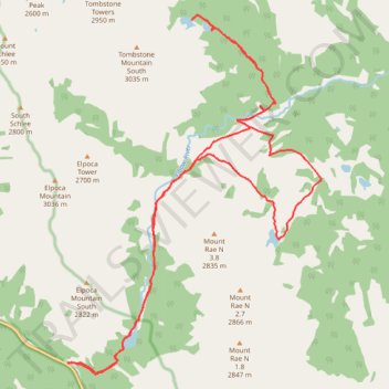
Interactive trail map
Trail profile
- Distance: 15.7 mi
- Elevation gain: 2,362 ft
- Maximum elevation: 7,244 ft
- Elevation loss: 2,365 ft
- Minimum elevation: 6,424 ft
- Moving time: 5 h 2 m
- Moving speed: 3.1 mph
- Maximum speed: 12.0 mph
- Total time: 6 h 12 m
- Global speed: 2.5 mph
About this trail
Name: Elbow Pass/Lake Trail, Tombstone Lakes and Rae Lake Loop trail, distance, elevation, map, profile, GPS track
Start: Elbow Lake Trail, Kananaskis Improvement District, Alberta, Canada (50.63564 -115.02404)
End: Kananaskis Trail, Kananaskis Improvement District, Alberta, Canada (50.63558 -115.02415)
Coordinates: 50.63374 -115.02422 50.69082 -114.96073