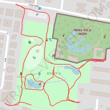
Yad LaBanim Park in Petah Tikva
- Distance: 0.9 mi
- Elevation gain: 39 ft
- Maximum elevation: 177 ft
- Elevation loss: 46 ft
- Minimum elevation: 148 ft
- Moving time: 20 m 48 s
- Moving speed: 2.7 mph
- Maximum speed: 4.0 mph
- Total time: 25 m 49 s
- Global speed: 2.1 mph
Interactive trail map
Trail profile
- Distance: 0.9 mi
- Elevation gain: 39 ft
- Maximum elevation: 177 ft
- Elevation loss: 46 ft
- Minimum elevation: 148 ft
- Moving time: 20 m 48 s
- Moving speed: 2.7 mph
- Maximum speed: 4.0 mph
- Total time: 25 m 49 s
- Global speed: 2.1 mph
About this trail
Name: Yad LaBanim Park in Petah Tikva trail, distance, elevation, map, profile, GPS track
Coordinates: 32.08587 34.87201 32.08812 34.87464