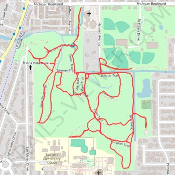
Hammock Park Trace
- Distance: 4.9 mi
- Elevation gain: 85 ft
- Maximum elevation: 33 ft
- Elevation loss: 92 ft
- Minimum elevation: 13 ft
- Moving time: 1 h 20 m
- Moving speed: 3.6 mph
- Maximum speed: 4.7 mph
- Total time: 1 h 20 m
- Global speed: 3.6 mph
Interactive trail map
Trail profile
- Distance: 4.9 mi
- Elevation gain: 85 ft
- Maximum elevation: 33 ft
- Elevation loss: 92 ft
- Minimum elevation: 13 ft
- Moving time: 1 h 20 m
- Moving speed: 3.6 mph
- Maximum speed: 4.7 mph
- Total time: 1 h 20 m
- Global speed: 3.6 mph
About this trail
Name: Hammock Park Trace trail, distance, elevation, map, profile, GPS track
Coordinates: 28.02879 -82.78440 28.03765 -82.77711
Topography: Pinellas County topographic map, elevation, terrain