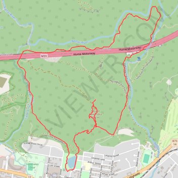
Alexandra Lake - Mount Alexandra - Katoomba Lookout
Interactive trail map
Trail profile
- Distance: 5.8 mi
- Elevation gain: 1,145 ft
- Maximum elevation: 2,589 ft
- Elevation loss: 1,145 ft
- Minimum elevation: 1,785 ft
About this trail
Name: Alexandra Lake - Mount Alexandra - Katoomba Lookout trail, distance, elevation, map, profile, GPS track
Coordinates: -34.44763 150.43881 -34.42656 150.46094
Other hiking, mountain biking, running and outdoor activity trails
Click on a trail to view its statistics, map and profile.