Gidjuum Gulganyi Complete
- Distance: 26.2 mi
- Elevation gain: 6,161 ft
- Maximum elevation: 2,694 ft
- Elevation loss: 5,728 ft
- Minimum elevation: 367 ft
- Moving time: 8 h 27 m
- Moving speed: 3.1 mph
- Maximum speed: 3.7 mph
- Total time: 8 h 27 m
- Global speed: 3.1 mph
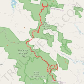
Interactive trail map
Trail profile
- Distance: 26.2 mi
- Elevation gain: 6,161 ft
- Maximum elevation: 2,694 ft
- Elevation loss: 5,728 ft
- Minimum elevation: 367 ft
- Moving time: 8 h 27 m
- Moving speed: 3.1 mph
- Maximum speed: 3.7 mph
- Total time: 8 h 27 m
- Global speed: 3.1 mph
About this trail
Name: Gidjuum Gulganyi Complete trail, distance, elevation, map, profile, GPS track
End: Minyon Falls Loop Road, Byron Shire Council, New South Wales, Australia (-28.61158 153.39049)
Coordinates: -28.61259 153.32858 -28.46612 153.39548
Other hiking, mountain biking, running and outdoor activity trails
Click on a trail to view its statistics, map and profile.