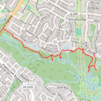
Potomac Heritage Trail section
- Distance: 1.7 mi
- Elevation gain: 115 ft
- Maximum elevation: 49 ft
- Elevation loss: 102 ft
- Minimum elevation: 7 ft
- Moving time: 34 m 13 s
- Moving speed: 3.0 mph
- Maximum speed: 9.2 mph
- Total time: 36 m 55 s
- Global speed: 2.8 mph
Interactive trail map
Trail profile
- Distance: 1.7 mi
- Elevation gain: 115 ft
- Maximum elevation: 49 ft
- Elevation loss: 102 ft
- Minimum elevation: 7 ft
- Moving time: 34 m 13 s
- Moving speed: 3.0 mph
- Maximum speed: 9.2 mph
- Total time: 36 m 55 s
- Global speed: 2.8 mph
About this trail
Name: Potomac Heritage Trail section trail, distance, elevation, map, profile, GPS track
Coordinates: 38.59117 -77.29812 38.59673 -77.28297
Topography: Prince William County topographic map, elevation, terrain