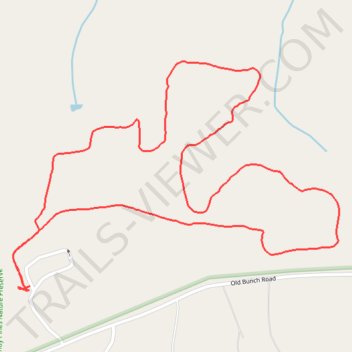
Sandy Pines Nature Preserve - Horseshoe Trail
- Distance: 2.4 mi
- Elevation gain: 72 ft
- Maximum elevation: 351 ft
- Elevation loss: 69 ft
- Minimum elevation: 305 ft
- Moving time: 50 m 42 s
- Moving speed: 2.8 mph
- Maximum speed: 3.8 mph
- Total time: 51 m 46 s
- Global speed: 2.8 mph
Interactive trail map
Trail profile
- Distance: 2.4 mi
- Elevation gain: 72 ft
- Maximum elevation: 351 ft
- Elevation loss: 69 ft
- Minimum elevation: 305 ft
- Moving time: 50 m 42 s
- Moving speed: 2.8 mph
- Maximum speed: 3.8 mph
- Total time: 51 m 46 s
- Global speed: 2.8 mph
About this trail
Name: Sandy Pines Nature Preserve - Horseshoe Trail trail, distance, elevation, map, profile, GPS track
Start: Wake County, North Carolina, 27951, United States (35.83238 -78.39102)
End: Wake County, North Carolina, 27951, United States (35.83243 -78.39094)
Coordinates: 35.83231 -78.39148 35.83826 -78.38103
Topography: Wake County topographic map, elevation, terrain