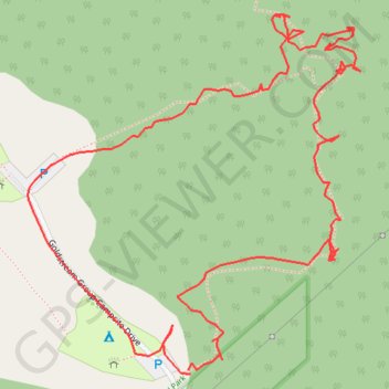
Trails, Goldstream Park, Langford, British Columbia
- Distance: 1.1 mi
- Elevation gain: 417 ft
- Maximum elevation: 630 ft
- Elevation loss: 417 ft
- Minimum elevation: 213 ft
- Moving time: 44 m 36 s
- Moving speed: 1.5 mph
- Maximum speed: 3.8 mph
- Total time: 1 h 11 m
- Global speed: 0.9 mph
Interactive trail map
Trail profile
- Distance: 1.1 mi
- Elevation gain: 417 ft
- Maximum elevation: 630 ft
- Elevation loss: 417 ft
- Minimum elevation: 213 ft
- Moving time: 44 m 36 s
- Moving speed: 1.5 mph
- Maximum speed: 3.8 mph
- Total time: 1 h 11 m
- Global speed: 0.9 mph
About this trail
Name: Trails, Goldstream Park, Langford, British Columbia trail, distance, elevation, map, profile, GPS track
Coordinates: 48.46385 -123.54770 48.46714 -123.54311
Other hiking, mountain biking, running and outdoor activity trails
Click on a trail to view its statistics, map and profile.
BBF loop to the Skydeck in Nanaimo
Canada > British Columbia > Cowichan Valley Regional District > Area A (Mill Bay / Malahat) > Mill Bay
BBF loop to the Skydeck
Distance: 201.0 mi • Elevation gain: 20,413 ft • Maximum elevation: 2,316 ft