Victoria Park
- Distance: 1.0 mi
- Elevation gain: 23 ft
- Maximum elevation: 1,089 ft
- Elevation loss: 23 ft
- Minimum elevation: 1,066 ft
- Moving time: 15 m 34 s
- Moving speed: 3.8 mph
- Maximum speed: 5.2 mph
- Total time: 15 m 34 s
- Global speed: 3.8 mph
Interactive trail map
Trail profile
- Distance: 1.0 mi
- Elevation gain: 23 ft
- Maximum elevation: 1,089 ft
- Elevation loss: 23 ft
- Minimum elevation: 1,066 ft
- Moving time: 15 m 34 s
- Moving speed: 3.8 mph
- Maximum speed: 5.2 mph
- Total time: 15 m 34 s
- Global speed: 3.8 mph
About this trail
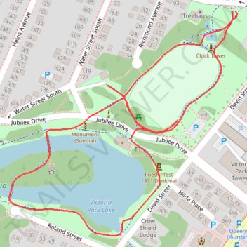
Name: Victoria Park trail, distance, elevation, map, profile, GPS track
Coordinates: 43.44575 -80.49795 43.44905 -80.49333