Thank you for supporting this site ❤️
Make a donation
Make a donation
Gear up for your next adventure:
As an Amazon Associate, this site earns from qualifying purchases at no extra cost to you.
Castle Bottom
- Distance: 2.1 mi
- Elevation gain: 141 ft
- Maximum elevation: 299 ft
- Elevation loss: 144 ft
- Minimum elevation: 243 ft
- Moving time: 58 m 35 s
- Moving speed: 2.2 mph
- Maximum speed: 3.9 mph
- Total time: 1 h 18 m
- Global speed: 1.6 mph
Interactive trail map
Thank you for supporting this site ❤️
Make a donation
Make a donation
Gear up for your next adventure:
As an Amazon Associate, this site earns from qualifying purchases at no extra cost to you.
Trail profile
- Distance: 2.1 mi
- Elevation gain: 141 ft
- Maximum elevation: 299 ft
- Elevation loss: 144 ft
- Minimum elevation: 243 ft
- Moving time: 58 m 35 s
- Moving speed: 2.2 mph
- Maximum speed: 3.9 mph
- Total time: 1 h 18 m
- Global speed: 1.6 mph
Thank you for supporting this site ❤️
Make a donation
Make a donation
Gear up for your next adventure:
As an Amazon Associate, this site earns from qualifying purchases at no extra cost to you.
About this trail
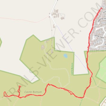
Name: Castle Bottom trail, distance, elevation, map, profile, GPS track
Coordinates: 51.33086 -0.86064 51.33735 -0.84937
Thank you for supporting this site ❤️
Make a donation
Make a donation
Gear up for your next adventure:
As an Amazon Associate, this site earns from qualifying purchases at no extra cost to you.