Drost park walking
- Distance: 0.9 mi
- Elevation gain: 13 ft
- Maximum elevation: 587 ft
- Elevation loss: 13 ft
- Minimum elevation: 577 ft
- Moving time: 18 m 51 s
- Moving speed: 2.9 mph
- Maximum speed: 29.9 mph
- Total time: 18 m 51 s
- Global speed: 2.9 mph
Interactive trail map
Trail profile
- Distance: 0.9 mi
- Elevation gain: 13 ft
- Maximum elevation: 587 ft
- Elevation loss: 13 ft
- Minimum elevation: 577 ft
- Moving time: 18 m 51 s
- Moving speed: 2.9 mph
- Maximum speed: 29.9 mph
- Total time: 18 m 51 s
- Global speed: 2.9 mph
About this trail
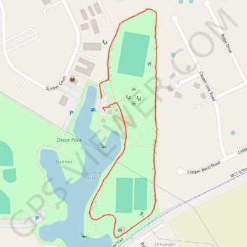
Name: Drost park walking trail, distance, elevation, map, profile, GPS track
Coordinates: 38.72714 -89.94932 38.73253 -89.94728
Topography: Madison County topographic map, elevation, terrain