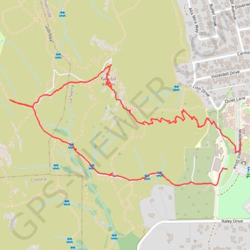
Two-bit Loop
- Distance: 1.9 mi
- Elevation gain: 591 ft
- Maximum elevation: 1,417 ft
- Elevation loss: 614 ft
- Minimum elevation: 837 ft
- Moving time: 55 m 8 s
- Moving speed: 2.1 mph
- Maximum speed: 10.8 mph
- Total time: 1 h 11 m
- Global speed: 1.6 mph
Interactive trail map
Trail profile
- Distance: 1.9 mi
- Elevation gain: 591 ft
- Maximum elevation: 1,417 ft
- Elevation loss: 614 ft
- Minimum elevation: 837 ft
- Moving time: 55 m 8 s
- Moving speed: 2.1 mph
- Maximum speed: 10.8 mph
- Total time: 1 h 11 m
- Global speed: 1.6 mph
About this trail
Name: Two-bit Loop trail, distance, elevation, map, profile, GPS track
Coordinates: 33.90938 -117.51417 33.91412 -117.50326
Topography: Riverside topographic map, elevation, terrain