
Amboy Crater Loop
Interactive trail map
Trail profile
- Distance: 2.1 mi
- Elevation gain: 269 ft
- Maximum elevation: 902 ft
- Elevation loss: 108 ft
- Minimum elevation: 659 ft
About this trail
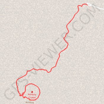
Name: Amboy Crater Loop trail, distance, elevation, map, profile, GPS track
Start: Crater Road, San Bernardino County, California, 92304, United States (34.55698 -115.78135)
End: Amboy Crater Trail, San Bernardino County, California, 92304, United States (34.54480 -115.79208)
Coordinates: 34.54379 -115.79334 34.55713 -115.78135
Topography: San Bernardino County topographic map, elevation, terrain