Import a GPX file

Berowra Valley Quarry Firetrail Loop

  • Distance: 6.6 mi
  • Elevation gain: 1,168 ft
  • Maximum elevation: 699 ft
  • Elevation loss: 1,171 ft
  • Minimum elevation: 164 ft
  • Moving time: 1 h 20 m
  • Moving speed: 5.0 mph
  • Maximum speed: 7.8 mph
  • Total time: 1 h 21 m
  • Global speed: 4.9 mph

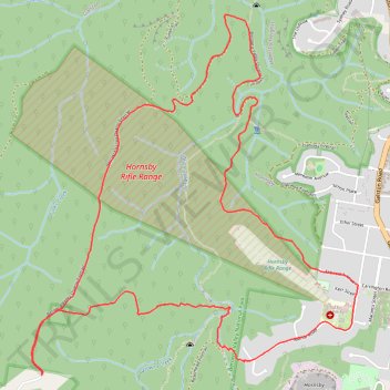
Interactive trail map

Trail profile

  • Distance: 6.6 mi
  • Elevation gain: 1,168 ft
  • Maximum elevation: 699 ft
  • Elevation loss: 1,171 ft
  • Minimum elevation: 164 ft
  • Moving time: 1 h 20 m
  • Moving speed: 5.0 mph
  • Maximum speed: 7.8 mph
  • Total time: 1 h 21 m
  • Global speed: 4.9 mph

About this trail

Name: Berowra Valley Quarry Firetrail Loop trail, distance, elevation, map, profile, GPS track

Start: Berowra Valley Quarry Firetrail, Dural, Sydney, New South Wales, 2158, Australia (-33.69630 151.07014)

End: Berowra Valley Quarry Firetrail, Dural, Sydney, New South Wales, 2158, Australia (-33.69639 151.07015)

Coordinates: -33.69639 151.06938 -33.67320 151.09461

Other hiking, mountain biking, running and outdoor activity trails

Click on a trail to view its statistics, map and profile.

Sydney - Katoomba

Australia > New South Wales > Sydney

#Bike #Loop

Distance: 137.3 mi • Elevation gain: 10,240 ft • Maximum elevation: 3,366 ft

Gear up for your next adventure:

📷Action Cameras - Rugged cameras to document your journeys across rugged terrain
Camping Coffee Makers - Enjoy premium coffee at the summit or campsite
🔥Fast-Boil Camping Stoves - Efficient cooking systems for quick trail meals
🧦Hiking Socks - Comfortable socks to prevent blisters on long hikes
💧Water Filtration Bottles - Safely drink from streams and lakes while exploring

As an Amazon Associate, this site earns from qualifying purchases at no extra cost to you.