Import a GPX file

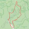
The Bluff Loop

Alpine National Park. #Hiking #Loop #Alpine

  • Distance: 25.5 mi
  • Elevation gain: 6,932 ft
  • Maximum elevation: 5,610 ft
  • Elevation loss: 6,932 ft
  • Minimum elevation: 2,713 ft

Interactive trail map

Trail profile

  • Distance: 25.5 mi
  • Elevation gain: 6,932 ft
  • Maximum elevation: 5,610 ft
  • Elevation loss: 6,932 ft
  • Minimum elevation: 2,713 ft

About this trail

Name: The Bluff Loop trail, distance, elevation, map, profile, GPS track

Start: Brocks Road, Mount Buller, Shire of Mansfield, Victoria, 3723, Australia (-37.26715 146.50015)

End: Brocks Road, Mount Buller, Shire of Mansfield, Victoria, 3723, Australia (-37.26702 146.49960)

Coordinates: -37.30240 146.48324 -37.19530 146.60601

Other hiking, mountain biking, running and outdoor activity trails

Click on a trail to view its statistics, map and profile.
Alpine National Park - Butcher Country Track

Australia > Victoria > Licola

#Bike #Loop #Alpine

Distance: 96.7 mi • Elevation gain: 14,731 ft • Maximum elevation: 5,364 ft

Gear up for your next adventure:

🧥Men's Rain Shells - Premium waterproof and breathable jackets for mountain weather
🥾Women's Hiking Boots - Top-rated trail boots with ankle support and superior grip
💧Water Filtration Bottles - Safely drink from streams and lakes while exploring
🧣Merino Neck Gaiters - Multi-functional headwear for wind and sun protection
🪑Portable Camp Table - Compact table for campsite meals

As an Amazon Associate, this site earns from qualifying purchases at no extra cost to you.