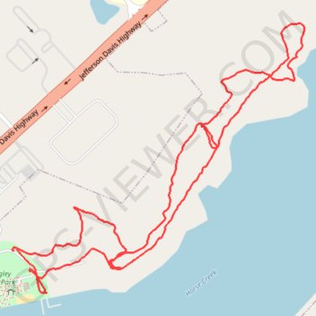
Walking at Langley Pond Park
- Distance: 2.2 mi
- Elevation gain: 154 ft
- Maximum elevation: 233 ft
- Elevation loss: 154 ft
- Minimum elevation: 177 ft
- Moving time: 46 m 40 s
- Moving speed: 2.8 mph
- Maximum speed: 5.3 mph
- Total time: 49 m 48 s
- Global speed: 2.6 mph
Interactive trail map
Trail profile
- Distance: 2.2 mi
- Elevation gain: 154 ft
- Maximum elevation: 233 ft
- Elevation loss: 154 ft
- Minimum elevation: 177 ft
- Moving time: 46 m 40 s
- Moving speed: 2.8 mph
- Maximum speed: 5.3 mph
- Total time: 49 m 48 s
- Global speed: 2.6 mph
About this trail
Name: Walking at Langley Pond Park trail, distance, elevation, map, profile, GPS track
Coordinates: 33.52438 -81.84560 33.53112 -81.83684
Topography: Aiken County topographic map, elevation, terrain