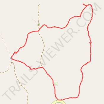
Huckleberry Ridge Conservation Area
- Distance: 2.9 mi
- Elevation gain: 351 ft
- Maximum elevation: 1,201 ft
- Elevation loss: 351 ft
- Minimum elevation: 1,014 ft
- Moving time: 1 h 24 m
- Moving speed: 2.1 mph
- Maximum speed: 3.3 mph
- Total time: 1 h 38 m
- Global speed: 1.8 mph
Interactive trail map
Trail profile
- Distance: 2.9 mi
- Elevation gain: 351 ft
- Maximum elevation: 1,201 ft
- Elevation loss: 351 ft
- Minimum elevation: 1,014 ft
- Moving time: 1 h 24 m
- Moving speed: 2.1 mph
- Maximum speed: 3.3 mph
- Total time: 1 h 38 m
- Global speed: 1.8 mph
About this trail
Name: Huckleberry Ridge Conservation Area trail, distance, elevation, map, profile, GPS track
Start: 5535, MO K, McDonald County, Missouri, 64856, United States (36.59873 -94.30309)
End: 5533, MO K, McDonald County, Missouri, 64856, United States (36.59870 -94.30327)
Coordinates: 36.59867 -94.31107 36.61065 -94.29850
Topography: McDonald County topographic map, elevation, terrain
Other hiking, mountain biking, running and outdoor activity trails
Click on a trail to view its statistics, map and profile.
Huckleberry Ridge Conservation Area
United States > Missouri > McDonald County > Meadors Ford
Distance: 3.1 mi • Elevation gain: 387 ft • Maximum elevation: 1,211 ft