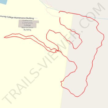
ICC (Isothermal Community College) Yellow Trail
- Distance: 0.8 mi
- Elevation gain: 49 ft
- Maximum elevation: 1,043 ft
- Elevation loss: 49 ft
- Minimum elevation: 997 ft
- Moving time: 15 m 57 s
- Moving speed: 2.9 mph
- Maximum speed: 6.0 mph
- Total time: 16 m 37 s
- Global speed: 2.8 mph
Interactive trail map
Trail profile
- Distance: 0.8 mi
- Elevation gain: 49 ft
- Maximum elevation: 1,043 ft
- Elevation loss: 49 ft
- Minimum elevation: 997 ft
- Moving time: 15 m 57 s
- Moving speed: 2.9 mph
- Maximum speed: 6.0 mph
- Total time: 16 m 37 s
- Global speed: 2.8 mph
About this trail
Name: ICC (Isothermal Community College) Yellow Trail trail, distance, elevation, map, profile, GPS track
Coordinates: 35.33549 -81.91045 35.33764 -81.90738
Topography: Rutherford County topographic map, elevation, terrain
Other hiking, mountain biking, running and outdoor activity trails
Click on a trail to view its statistics, map and profile.
ICC (Isothermal Community College) Orange Trail
United States > North Carolina > Rutherford County > Forest City
Distance: 0.8 mi • Elevation gain: 66 ft • Maximum elevation: 1,063 ft