Make a donation
Gear up for your next adventure:
As an Amazon Associate, this site earns from qualifying purchases at no extra cost to you.
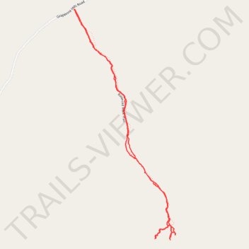
Balanced Rock Trail from Grapevine Hills Road - Chihuahuan Desert
- Distance: 2.3 mi
- Elevation gain: 312 ft
- Maximum elevation: 3,501 ft
- Elevation loss: 312 ft
- Minimum elevation: 3,225 ft
- Moving time: 1 h 2 m
- Moving speed: 2.2 mph
- Maximum speed: 5.6 mph
- Total time: 1 h 57 m
- Global speed: 1.2 mph
Interactive trail map
Make a donation
Gear up for your next adventure:
As an Amazon Associate, this site earns from qualifying purchases at no extra cost to you.
Trail profile
- Distance: 2.3 mi
- Elevation gain: 312 ft
- Maximum elevation: 3,501 ft
- Elevation loss: 312 ft
- Minimum elevation: 3,225 ft
- Moving time: 1 h 2 m
- Moving speed: 2.2 mph
- Maximum speed: 5.6 mph
- Total time: 1 h 57 m
- Global speed: 1.2 mph
Make a donation
Gear up for your next adventure:
As an Amazon Associate, this site earns from qualifying purchases at no extra cost to you.
About this trail
Name: Balanced Rock Trail from Grapevine Hills Road - Chihuahuan Desert trail, distance, elevation, map, profile, GPS track
Start: Balanced Rock Trail, Brewster County, Texas, United States (29.41042 -103.20760)
End: Balanced Rock Trail, Brewster County, Texas, United States (29.41038 -103.20760)
Coordinates: 29.39879 -103.20766 29.41042 -103.20176
Topography: Brewster County topographic map, elevation, terrain
Make a donation
Gear up for your next adventure:
As an Amazon Associate, this site earns from qualifying purchases at no extra cost to you.