Make a donation
Gear up for your next adventure:
As an Amazon Associate, this site earns from qualifying purchases at no extra cost to you.
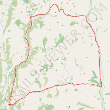
Mountain Bike Loop Ride via Waiau Toa / Clarence River, Fowlers Pass, Stanley River, Charlies Saddle and Edwards River
- Distance: 36.6 mi
- Elevation gain: 4,409 ft
- Maximum elevation: 4,268 ft
- Elevation loss: 4,409 ft
- Minimum elevation: 2,083 ft
- Moving time: 7 h 32 m
- Moving speed: 4.9 mph
- Maximum speed: 25.5 mph
- Total time: 9 h 58 m
- Global speed: 3.7 mph
Interactive trail map
Make a donation
Gear up for your next adventure:
As an Amazon Associate, this site earns from qualifying purchases at no extra cost to you.
Trail profile
- Distance: 36.6 mi
- Elevation gain: 4,409 ft
- Maximum elevation: 4,268 ft
- Elevation loss: 4,409 ft
- Minimum elevation: 2,083 ft
- Moving time: 7 h 32 m
- Moving speed: 4.9 mph
- Maximum speed: 25.5 mph
- Total time: 9 h 58 m
- Global speed: 3.7 mph
Make a donation
Gear up for your next adventure:
As an Amazon Associate, this site earns from qualifying purchases at no extra cost to you.
About this trail
Name: Mountain Bike Loop Ride via Waiau Toa / Clarence River, Fowlers Pass, Stanley River, Charlies Saddle and Edwards River trail, distance, elevation, map, profile, GPS track
Start: Tophouse Road, Hurunui District, New Zealand (-42.41196 172.79480)
End: Peters Valley Track, Hurunui District, New Zealand (-42.41206 172.79470)
Coordinates: -42.43815 172.61972 -42.29683 172.79480
Make a donation
Gear up for your next adventure:
As an Amazon Associate, this site earns from qualifying purchases at no extra cost to you.
Other hiking, mountain biking, running and outdoor activity trails
Click on a trail to view its statistics, map and profile.