Silver Star Mountain
Silver Star Provincial Park. #Hiking #Loop #SilverStar
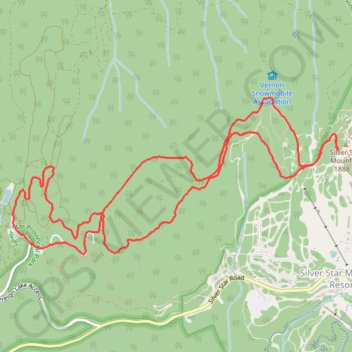
- Distance: 6.7 mi
- Elevation gain: 899 ft
- Maximum elevation: 6,175 ft
- Elevation loss: 899 ft
- Minimum elevation: 5,456 ft
Interactive trail map
Trail profile
- Distance: 6.7 mi
- Elevation gain: 899 ft
- Maximum elevation: 6,175 ft
- Elevation loss: 899 ft
- Minimum elevation: 5,456 ft
About this trail
Name: Silver Star Mountain trail, distance, elevation, map, profile, GPS track
Coordinates: 50.36024 -119.10482 50.37248 -119.06486
Other hiking, mountain biking, running and outdoor activity trails
Click on a trail to view its statistics, map and profile.