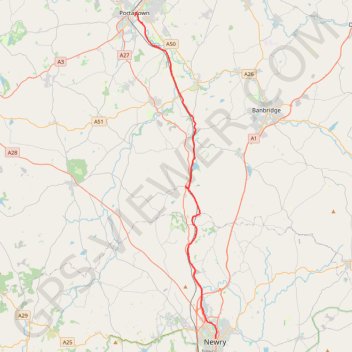
Portadown to Newry by the Newry Canal Towpath
Bike from Portadown to Newry via the Upper Bann, the Cusher River, the Newry Canal Towpath and the Lough Shark. #Bike #River #Canal #Nature #Lake
- Distance: 20.7 mi
- Elevation gain: 466 ft
- Maximum elevation: 102 ft
- Elevation loss: 509 ft
- Minimum elevation: 20 ft
- Moving time: 1 h 31 m
- Moving speed: 13.6 mph
- Maximum speed: 29.5 mph
- Total time: 2 h 18 m
- Global speed: 8.9 mph
Interactive trail map
Trail profile
- Distance: 20.7 mi
- Elevation gain: 466 ft
- Maximum elevation: 102 ft
- Elevation loss: 509 ft
- Minimum elevation: 20 ft
- Moving time: 1 h 31 m
- Moving speed: 13.6 mph
- Maximum speed: 29.5 mph
- Total time: 2 h 18 m
- Global speed: 8.9 mph
About this trail
Name: Portadown to Newry by the Newry Canal Towpath trail, distance, elevation, map, profile, GPS track
Coordinates: 54.17963 -6.44038 54.42376 -6.33511
Other hiking, mountain biking, running and outdoor activity trails
Click on a trail to view its statistics, map and profile.
CTS-N.Irelandv1.1-Belfast-Titanic>Enniscrone-via antrim coast-209miles
United Kingdom > Northern Ireland > County Down > Belfast
Distance: 208.7 mi • Elevation gain: 13,074 ft • Maximum elevation: 889 ft
Newry Canal Towpath
United Kingdom > Northern Ireland > County Armagh > Portadown
Distance: 20.1 mi • Elevation gain: 312 ft • Maximum elevation: 95 ft