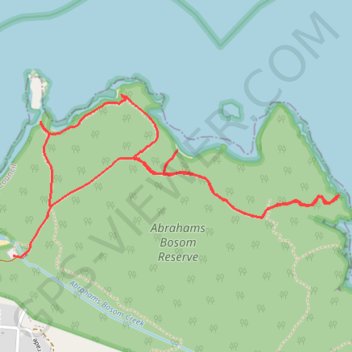
Abrahams Bosom Reserve
- Distance: 3.5 mi
- Elevation gain: 302 ft
- Maximum elevation: 89 ft
- Elevation loss: 302 ft
- Minimum elevation: 0 ft
Interactive trail map
Trail profile
- Distance: 3.5 mi
- Elevation gain: 302 ft
- Maximum elevation: 89 ft
- Elevation loss: 302 ft
- Minimum elevation: 0 ft
About this trail
Name: Abrahams Bosom Reserve trail, distance, elevation, map, profile, GPS track
Coordinates: -35.01098 150.82856 -35.00389 150.84591
Other hiking, mountain biking, running and outdoor activity trails
Click on a trail to view its statistics, map and profile.
Ulladulla - Minnamurra
Australia > New South Wales > Burrill Lake
#Bike
Distance: 79.4 mi • Elevation gain: 5,338 ft • Maximum elevation: 469 ft