Import a GPX file

Mount Pleasant Summit Trail

#Hiking #MTB #Loop

  • Distance: 8.2 mi
  • Elevation gain: 715 ft
  • Maximum elevation: 1,781 ft
  • Elevation loss: 715 ft
  • Minimum elevation: 1,424 ft

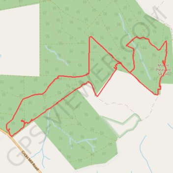
Interactive trail map

Trail profile

  • Distance: 8.2 mi
  • Elevation gain: 715 ft
  • Maximum elevation: 1,781 ft
  • Elevation loss: 715 ft
  • Minimum elevation: 1,424 ft

About this trail

Gear up for your next adventure:

🛰️Satellite Messengers - Emergency SOS and two-way messaging for off-grid adventures
🧯Emergency Survival Kit - All‑in‑one survival essentials for the backcountry
🔪Outdoor Multitools - Essential survival tools for gear repair and field use
🧴Hand Sanitizer - Keep hands clean while hiking
🛶Inflatable Kayak - Portable kayak for rivers, lakes, and expeditions

As an Amazon Associate, this site earns from qualifying purchases at no extra cost to you.