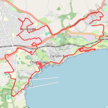
St Austell
- Distance: 17.2 mi
- Elevation gain: 1,982 ft
- Maximum elevation: 354 ft
- Elevation loss: 1,975 ft
- Minimum elevation: 0 ft
- Moving time: 7 h 20 m
- Moving speed: 2.3 mph
- Maximum speed: 20.8 mph
- Total time: 8 h 45 m
- Global speed: 2.0 mph
Interactive trail map
Trail profile
- Distance: 17.2 mi
- Elevation gain: 1,982 ft
- Maximum elevation: 354 ft
- Elevation loss: 1,975 ft
- Minimum elevation: 0 ft
- Moving time: 7 h 20 m
- Moving speed: 2.3 mph
- Maximum speed: 20.8 mph
- Total time: 8 h 45 m
- Global speed: 2.0 mph
About this trail
Name: St Austell trail, distance, elevation, map, profile, GPS track
Coordinates: 50.31990 -4.77851 50.35205 -4.71949