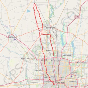
ThrottleCo_River_Roads_Loop
- Distance: 66.2 mi
- Elevation gain: 1,355 ft
- Maximum elevation: 984 ft
- Elevation loss: 1,293 ft
- Minimum elevation: 709 ft
Interactive trail map
Trail profile
- Distance: 66.2 mi
- Elevation gain: 1,355 ft
- Maximum elevation: 984 ft
- Elevation loss: 1,293 ft
- Minimum elevation: 709 ft
About this trail
Name: ThrottleCo_River_Roads_Loop trail, distance, elevation, map, profile, GPS track
Coordinates: 39.94580 -83.19751 40.44543 -83.02826
Topography: Columbus topographic map, elevation, terrain