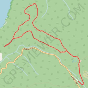
Cape Breton Island - Skyline Trail
#Hiking #Loop #CapeBreton
- Distance: 5.9 mi
- Elevation gain: 692 ft
- Maximum elevation: 1,322 ft
- Elevation loss: 692 ft
- Minimum elevation: 817 ft
Interactive trail map
Trail profile
- Distance: 5.9 mi
- Elevation gain: 692 ft
- Maximum elevation: 1,322 ft
- Elevation loss: 692 ft
- Minimum elevation: 817 ft
About this trail
Name: Cape Breton Island - Skyline Trail trail, distance, elevation, map, profile, GPS track
Start: Cape Breton Highlands National Park, Inverness County, Nova Scotia, Canada (46.73814 -60.88117)
End: Cape Breton Highlands National Park, Inverness County, Nova Scotia, Canada (46.73811 -60.88113)
Coordinates: 46.73721 -60.91088 46.75950 -60.87905