Import a GPX file

Wild Rose Loop

Brown-Lowery Provincial Park. #Hiking #Loop #Forest #Nature

  • Distance: 3.0 mi
  • Elevation gain: 354 ft
  • Maximum elevation: 4,669 ft
  • Elevation loss: 354 ft
  • Minimum elevation: 4,380 ft

Interactive trail map

Trail profile

  • Distance: 3.0 mi
  • Elevation gain: 354 ft
  • Maximum elevation: 4,669 ft
  • Elevation loss: 354 ft
  • Minimum elevation: 4,380 ft

About this trail

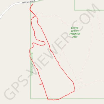
Name: Wild Rose Loop trail, distance, elevation, map, profile, GPS track

Start: Plummers Road W, Foothills County, Alberta, Canada (50.82036 -114.43948)

End: Plummers Road W, Foothills County, Alberta, Canada (50.82036 -114.43948)

Coordinates: 50.80476 -114.44033 50.82036 -114.42883

Gear up for your next adventure:

🛌Ultralight Sleeping Bags - Compact down bags for cold nights in the wilderness
📶Vehicle Signal Boosters - Improve reception in rural areas while driving to trailheads
🪶LED Camping Lantern - Bright lantern for camp lighting
🧷Carabiner Set - Durable clips for gear attachment
🎒Waterproof Dry Bags - Keep your electronics and maps dry inside your pack

As an Amazon Associate, this site earns from qualifying purchases at no extra cost to you.