Ribble and Holmfirth Cliff
- Distance: 3.7 mi
- Elevation gain: 466 ft
- Maximum elevation: 906 ft
- Elevation loss: 469 ft
- Minimum elevation: 591 ft
- Moving time: 1 h 57 m
- Moving speed: 1.9 mph
- Maximum speed: 2.8 mph
- Total time: 2 h 26 m
- Global speed: 1.5 mph
Interactive trail map
Trail profile
- Distance: 3.7 mi
- Elevation gain: 466 ft
- Maximum elevation: 906 ft
- Elevation loss: 469 ft
- Minimum elevation: 591 ft
- Moving time: 1 h 57 m
- Moving speed: 1.9 mph
- Maximum speed: 2.8 mph
- Total time: 2 h 26 m
- Global speed: 1.5 mph
About this trail
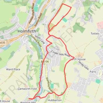
Name: Ribble and Holmfirth Cliff trail, distance, elevation, map, profile, GPS track
Coordinates: 53.55759 -1.78636 53.57547 -1.77195
Other hiking, mountain biking, running and outdoor activity trails
Click on a trail to view its statistics, map and profile.
Washpit Mill via Holmfirth and Wooldale
United Kingdom > England > Kirklees > Holmfirth > Washpit Mill
Distance: 3.3 mi • Elevation gain: 417 ft • Maximum elevation: 909 ft
Cartworth Moor checkout
United Kingdom > England > Kirklees > Holmfirth > Washpit Mill
Distance: 2.7 mi • Elevation gain: 446 ft • Maximum elevation: 1,073 ft
Cartworth Moor Loop
United Kingdom > England > Kirklees > Holmfirth > Washpit Mill
Distance: 3.5 mi • Elevation gain: 515 ft • Maximum elevation: 1,135 ft