Thank you for supporting this site ❤️
Make a donation
Make a donation
Gear up for your next adventure:
As an Amazon Associate, this site earns from qualifying purchases at no extra cost to you.
Mount Arbel
Interactive trail map
Thank you for supporting this site ❤️
Make a donation
Make a donation
Gear up for your next adventure:
As an Amazon Associate, this site earns from qualifying purchases at no extra cost to you.
Trail profile
- Distance: 1.6 mi
- Elevation gain: 830 ft
- Maximum elevation: 551 ft
- Elevation loss: 833 ft
- Minimum elevation: 144 ft
Thank you for supporting this site ❤️
Make a donation
Make a donation
Gear up for your next adventure:
As an Amazon Associate, this site earns from qualifying purchases at no extra cost to you.
About this trail
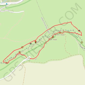
Name: Mount Arbel trail, distance, elevation, map, profile, GPS track
Coordinates: 32.82133 35.49228 32.82572 35.50228
Thank you for supporting this site ❤️
Make a donation
Make a donation
Gear up for your next adventure:
As an Amazon Associate, this site earns from qualifying purchases at no extra cost to you.
Other hiking, mountain biking, running and outdoor activity trails
Click on a trail to view its statistics, map and profile.
Mount Arbel
Israel > North District > Tiberias
Distance: 6.0 mi • Elevation gain: 2,552 ft • Maximum elevation: 535 ft