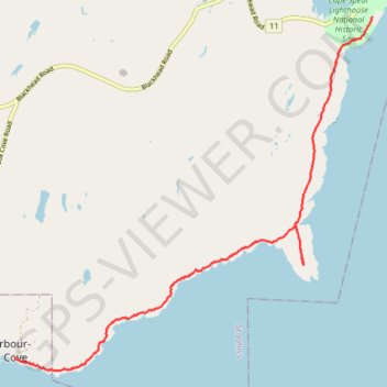
East Coast Trail - Cape Spear Path
#Hiking #Newfoundland #Atlantic
- Distance: 6.8 mi
- Elevation gain: 945 ft
- Maximum elevation: 292 ft
- Elevation loss: 814 ft
- Minimum elevation: 7 ft
Interactive trail map
Trail profile
- Distance: 6.8 mi
- Elevation gain: 945 ft
- Maximum elevation: 292 ft
- Elevation loss: 814 ft
- Minimum elevation: 7 ft
About this trail
Name: East Coast Trail - Cape Spear Path trail, distance, elevation, map, profile, GPS track
Coordinates: 47.47078 -52.69843 47.52152 -52.62251
Other hiking, mountain biking, running and outdoor activity trails
Click on a trail to view its statistics, map and profile.
Whitbourne - St. John's
Canada > Newfoundland and Labrador > Whitbourne
#Bike #Whitbourne #StJohns #Newfoundland #Atlantic
Distance: 64.2 mi • Elevation gain: 4,035 ft • Maximum elevation: 768 ft